Categories
climate change environment Hawaii

Hawaii’s highest lake is…disappearing

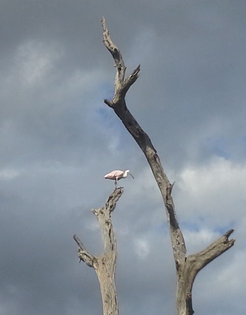
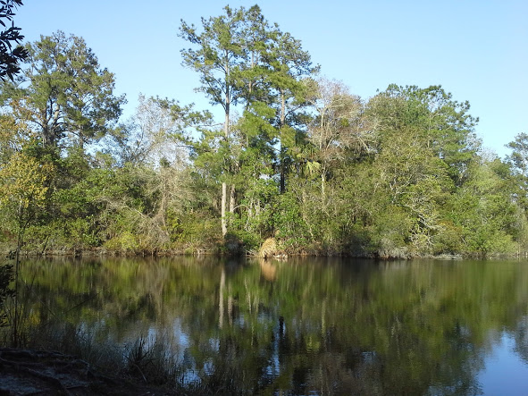
The Hawaiian Islands have very few permanent natural lakes. In fact, there are only four lakes on the main Hawaiian Islands (there is one on Laysan Island, as well). All four sit in the bottom of volcanic cinder cones or craters, making them pretty small in area, but potentially very deep.

  • Lake Wai’ele’ele is located in a high-altitude rainforest in the East Maui Mountains.
  • Lake Kauhako, on Molokai’s Kalaupapa Peninsula, has the highest ratio of depth to surface area in the world (meaning it’s pretty small, but very deep).
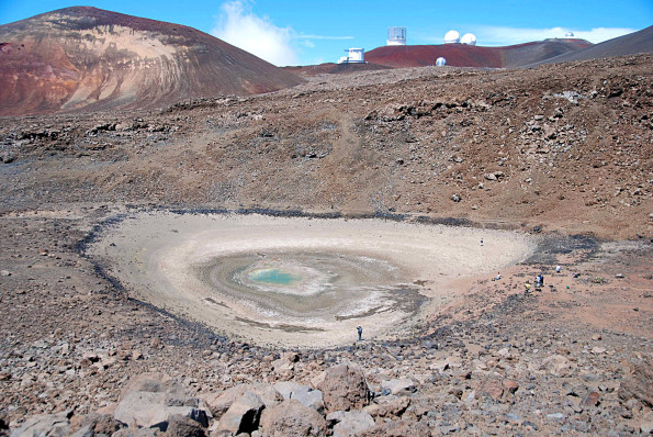
  • Lake Waiau is one of the highest lakes in the U.S. (possibly #3, though that’s apparently disputed), located at over 13,000 feet elevation on Mauna Kea.
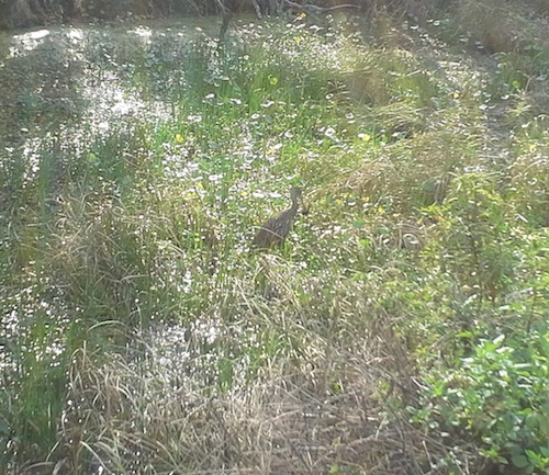
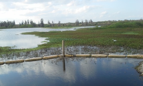
  • Green Lake, in the Puna district of Hawaii, is probably the easiest to get to, as you don’t need a helicopter, mule, or 4-wheel drive vehicle to get to it.
  • Oahu used to have a fifth lake, Salt Lake, which is now the site of a residential area and golf course (though there might be a remnant body of water there).

Lake Waiau has been in the news for the last few weeks for a very disturbing reason- it has been shrinking. A lot. As of late September, it was only at about 2% of its normal surface area!

Lake Waiau. The dark rocks surrounding the pale area mark the usual edge of the lake. There are people at the bottom and right side of the lake for scale. (Photo from USGS).

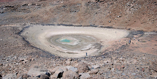
Lake Waiau’s dramatic shrinking has been going on for at least a year. The reasons are not well understood, but are most likely linked to an ongoing drought in Hawaii, combined with rising temperatures. The lake is perched on what is normally really permeable volcanic cinders (think pumice stone). A layer of clay, permafrost, or some combination of the two (scientists aren’t sure which) rests under the lake bed, normally making the cinders stick together and holding the water in place.

In case you’re wondering, yes- permafrost. During the last Ice Age, there were glaciers on Mauna Loa and Mauna Kea, and there may still be frozen ground a bit under the surface of the top of Mauna Kea (Mauna Loa is too volcanically active).  But if the lake is resting on permafrost, its days are numbered. High-altitude temperatures are increasing three times higher on Mauna Kea than the global average. Even if there’s not a melting layer of permafrost underneath, rising temperatures mean more evaporation, and when combined with little winter snowfall, clearly the lake is already in trouble.

A wider-angle view of Lake Waiau. You can see the cinder cones that make up the top of Mauna Kea, as well as several of the astronomical observatories nearby. (Photo from USGS)

As the only alpine lake in Hawaii, Lake Waiau was and is sacred to Native Hawaiians. From a scientific standpoint, its geology and ecology are unique. While its current problems likely stem from drought, its future is tied to our warming climate. Like many other unique and culturally significant locations worldwide, Lake Waiau’s fate seems to be one of drastic change.

Categories
environment meetings science communication

At the Sea Level Rise Summit

We’re currently halfway through the 2013 Sea Level Rise Summit in Fort Lauderdale. I have a poster up at the meeting about the coastal dynamics of sea level rise project (or Ecological Effects of Sea Level Rise in the Northern Gulf of Mexico/EESLR-NGOM).

On the Coastal Dynamics of Sea Level Rise...
On the Coastal Dynamics of Sea Level Rise…

After having listened to and interacted with a wide variety of people from the sciences, communication, law, politics, and public health, the highlight of the day has to be stepping out of a car downtown on the way to the evening’s reception and nearly missing going ankle-deep into a puddle of seawater rising up through a storm drain. South Florida has a major problem with sea level rise and salt water intruding into the cities-so much so that on a completely rainless day with no wind, a high tide can push water up through the grates. So this was a perfect illustration of the challenges that this region faces in the future.

Categories
birds environment Florida outdoors

Circle Bar B Reserve

I just realized that I’d been remiss in posting some photos from a hike we went on way back in February. Not that I’ve been consistently posting anything but rabbit photos lately, but anyway…

We went on a weekend trip to Tampa in the first part of February (the kittiwake-spotting  trip), and on the way back stopped at the Circle Bar B Reserve in Lakeland. As you might guess from the name, this is a former ranch (and phosphate mining site) that’s been partially turned into a wildlife preserve. It’s a good place for birding, and seemed quite popular on a Sunday afternoon.

Sandhill cranes at Circle Bar B.

I was really hoping to see some fulvous whistling-ducks there. Not only because these are interesting birds in and of themselves, but also how can you resist looking for a bird whose name combines an obscure color with the adorable whistling sounds it makes?

Fulvous.
Fulvous.

Sadly, it was not to be. Even though several families of fulvous whistling-ducks were reported that weekend on eBird (including with infuriating comments like “Really obvious, right by the trail”), we were not able to see any. But we had fun anyway.

Spoonbill in a tree.

We had a nice walk- the weather was quite pleasant- and saw a lot of birds and other wildlife. One of the highlights was a mother gator and her recently-hatched brood of babies. They were clearly acclimated to human attention. We assumed they were pretty close to their former nest site, which was right by the trail. Probably not a bad place for a nest, as long as you can stand the noisy human presence-maybe it helped keep the other adult alligators away.

Gator family. The mother is on the right, and babies on the left. They're pretty well camouflaged.
Gator family. The mother is on the right, and babies on the left. They’re pretty well camouflaged & just look like ridges in the muck.

Circle Bar B includes quite a bit of upland habitat, including some pine flatwoods and oak forest. However, it’s the system of ponds that are exciting to birders. There was quite a variety of wading birds, along with woodpeckers, warblers, and some raptors.

Another gator baby.
Another gator baby.

One of the highlights was a massive black & turkey vulture roost (YMMV). The birds perch in cypresses and pines along both sides of the trail. Since we were there until late afternoon, they were starting to fly in to sleep. It’s neat to hear their feathers swooshing in the wind when you’re close to them.

Limpkin on a tree.
Limpkin on a tree. The spots in the sky weren’t from a dirty lens- they’re swallows.

We also saw quite a few limpkins. These are fairly uncommon big wading birds that eat snails. While they’re solitary, we did see a lot of them in close proximity. I guess it’s good snail habitat.

Limpkin with snail.
Limpkin with snail.

After doing a big loop through the ponds, we swung by a lake before heading back to the car. It was an interesting place to visit, and it would be fun to go back at some point.

Winter day at Circle Bar B.
Categories
birds environment Florida outdoors

Walking in Seminole County

The weekend before last, I went to the Earth Day festivities at Seminole County’s Environmental Studies Center. This is a small nature center near the southeast corner of Lake Jesup; I’d previously biked past it on the Cross Seminole Trail, but never visited.

20130413_130558
Early afternoon at the nature center.

I took a short stroll on the center’s trails after the event- not too far, but it was nice to get into the outdoors. There weren’t too many birds, because it was pretty warm in the early afternoon.

20130413_131157
Moss and droopy bark.

It’s apparently a good spot to see migrating warblers (and other forest birds) early in the morning at this time of year. I did see (and hear) the ubiquitous cardinals, catbirds, and blue-gray gnatcatchers. I also heard a red-shouldered hawk or two and saw a swallow-tailed kite soaring overhead.

20130413_131058
Wildflowers.

The area is pretty damp, as it’s pretty close to the lake. I’m sure it gets even wetter during the summer.

20130413_130644
Light through the palm fronds.

I’m not sure how extensive the trail system is, but it might be fun to go back and explore.

20130413_131700
Thick, wavy patterns in the pine bark.
Categories
bunny environment evolution

Friday bunnyblogging: snowshoe hares & climate change

There’s an old saying about the leopard not being able to change its spots. But snowshoe hares do it twice a year: replacing a thick white winter coat with a lighter brown summer coat.

Summer-coated snowshoe hare (Image: Walter Siegmund).

European rabbits, which is what Noe is, don’t do this- she does shed twice a year, but her fur is the same color each time.

Winter-coated hare (Image: D. Gordon E. Robertson).

For hares, the timing of the coat replacements is roughly correlated with snowfall, and it’s easy to picture how a white coat helps camouflage them in winter and a brown one in summer. But there’s a problem: climate change means that seasons are shifting, so their white coats come in too soon and stay too long. This is a big problem for the hares: white makes them stand out to predators on a brown (or green) background.

In theory, natural selection will weigh heavily on hares in the years to come: the hares that have coat-changing cycles that more closely match snowfall will survive, while those with the older cycle will probably be eaten. Over time, the hare population will adapt to the new seasons. But there are two big IFs here: this will only happen IF the seasonal changes happen slowly enough so that the hares have time to adapt, and IF all the hares aren’t preyed upon faster than the survivors can have babies.

Because hares breed like…rabbits (sorry, couldn’t resist the cliche), they will probably be okay in the long term. But there are many, many other species for whom rapid climate change will create insurmountable problems in the decades to come.

For more on the story, go here: http://news.sciencemag.org/sciencenow/2013/04/color-changing-hare-cant-keep-up.html?ref=hp

Categories
birds environment Florida outdoors

Hiking Wekiwa Springs SP

Last week, we took advantage of a warm day to do some hiking in Wekiwa Springs State Park. The park has a pretty varied landscape- aside from the eponymous spring and spring run, with its riparian swamp, there are oak savannah & pine flatwoods communities. We ended up hiking about 4 miles round-trip from the main parking area by the spring to the tiny Sand Lake.

Ferns and other plants were sending up new spring shoots.
Bracken ferns and other plants were sending up new spring shoots.

Once you get out of the swampy hammock near the spring, a few feet of elevation difference is enough to make the landscape very dry. I’ve heard peninsular Florida called a desert with a monsoon season, and we’re definitely in the dry season now (though it’s ironically raining as I write this- but the first rain we’ve had in over two weeks).

Pine-palm savannah.
Pine-palm-oak forest.

We did see a few flowers blooming, but I think the majority of the floral action happens a bit later in the year. I wasn’t able to ID these plants, but they soften this log in an interesting way:

20130308_164920
Spring wildflowers in the flatwoods.

The trail runs pretty close to the road- other trails do go into the parts of the park where you can’t drive, and I think we’ll explore those next time we come here. Wekiwa Spring itself is endangered by excessive water withdrawal and nutrient pollution from fertilizer use and poorly-regulated septic tanks in the area. When you’re walking on dry, sandy soil like this, it’s sometimes hard to remember that only a few feet underground there’s a shallow but wide groundwater system. Any change to that water affects the spring.

Sand Lake on a cloudless day.

We saw a fair number of birds, given that it was fairly late in the day- there was a lot of warbler & gnatcatcher activity in the trees overhead. We also heard a barred owl that was probably roosting near the spring area, and saw several swallow-tailed kites soaring gracefully overhead. I’ve seen kites dip down in flight to drink water from the river at Wekiwa before- a pretty neat sight.

More Sand Lake.
More Sand Lake.

One thing that would have made the experience more enjoyable was bug spray- the mosquitoes aren’t out yet, but we were unpleasantly surprised that the population of no-see-um’s was going strong already. Though at least no-see-um bites don’t itch.

Yan walking through pine flatwoods.

We saw several other people on the trail, including a few people walking their dogs. Noe is definitely not the type of pet that can go on hikes with us- especially with all the aerial predators and who knows what lurking in the underbrush.

A big pine had fallen across the path and split this sapling.

One interesting thing we noticed was that in places near water, the moister air was really evident. So it’s not just the soil that has large moisture variations-it’s the air as well.

Crossing a tiny stream.

I find the oaky areas generally prettier to walk through than the drier plant communities. Though obviously this is an aesthetic preference. I like the dappled light through the branches and their clinging lichens.

Afternoon sun on the trail.

Aside from birds, we saw a few arthropods and the ubiquitous gray squirrels. We didn’t see any fox squirrels, though they’re supposed to live in the park.

Cup-shaped spiderweb in the forest.

The day’s bird list: Black Vulture, Turkey Vulture, Swallow-tailed Kite, Red-shouldered Hawk, Mourning Dove, Barred Owl, Red-bellied Woodpecker, Yellow-bellied Sapsucker, Downy Woodpecker, Carolina Chickadee, Carolina Wren, Blue-gray Gnatcatcher, Ruby-crowned Kinglet, Hermit Thrush, American Robin, Gray Catbird, Black-and-white Warbler, Northern Parula, Palm Warbler, Pine Warbler, Yellow-rumped Warbler

All in all, it was a nice short hike. Definitely a place to return to and explore further- both by foot and by canoe.

Categories
environment information representation maps visuals

Want to see a map of every cyclone since 1851?

This is timely, since Florida’s first cyclone threat of 2012 is churning toward us in the Caribbean.

Want to see a map of every hurricane tracked since 1851? This is a really cool visualization of this data, though it may take a minute to orient yourself to the map projection:

Click to enlarge. Image copyright IDVsolutions .

Really, this should be called a cyclone map, because it includes all cyclonic storms: both tropical storms and hurricanes/typhoons/cyclones, depending on linguistic preferences. But it’s an American map, so the creator apparently chose to go with “hurricane.” A blog post in which the creator talks about making the map is here.

The brightness intensity of the Atlantic & E. Pacific storms seems enhanced compared to that of the W. Pacific and Indian Ocean storms. I suspect this is because tracking of these storms by NOAA (which is where the dataset comes from) started rather late. It’s a bit unfortunate, because one of the things people will do is compare the prevalence of cyclones in various regions, and the Philippine Sea, S. China Sea, and W. Pacific are very active regions for cyclones. So the overall effect is to give an unbalanced view of the activity in various regions. (Admittedly, I haven’t looked at the data myself, so my concern might be unfounded here.)

Still, a very interesting visualization!

Categories
environment Hawaii public participation in science

Crowdsourcing project: Hawaiian Monk Seals

Want to help fund some cool research in an interesting species? Here’s your chance.

Hawaiian Monk Seals, or `Īlioholoikauaua (translated as “dogs that play in the waves”), are a critically endangered and declining species that used to live throughout the Hawaiian archipelago. Today, though, they’re mainly found on the mostly uninhabited Northwest Hawaiian Islands. A relatively small number of seals are also returning to the main Hawaiian Islands, as well, but human encroachment, coastline development, and entanglement with fishing lines make their presence in populated areas more difficult.

Monachus schauinslandi (Hawaiian Monk Seal) underwater at Five Fathom Pinnacle, Hawaii. (Image: Kent Backman, CC-BY-SA-3.0)

While many members of the local community support the conservation of this native species- one of only two native Hawaiian mammals- some fishermen view the seals as competitors for fish. In the last few months, there have been several shootings and clubbings of monk seals who were resting on shore or preparing to give birth. The suspicion is that a very few subsistence fishermen, whose livelihoods are already threatened by coastal development, pollution, and existing overfishing, have been targeting the seals out of frustration. Because seals have only been returning to the main Hawaiian Islands for the last few decades, some fishermen view them as a new competitor, rather than an intrinsic part of the ecosystem that is only now recovering from near-extinction a hundred years ago.

But are the monk seals actually competitors for fish? Previous research on monk seals, using “crittercams” that are attached to the seals’ backs, shows that they actually feed much farther out to sea and deeper than the struggling fishermen. In an effort to understand more about how monk seals behave, the Monk Seal Foundation israising founds for the Hōʻike ā Maka Project:

This is the goal of the Hōʻike ā Maka Project: to understand and share images of the feeding and underwater behavior of Hawaiian monk seals, and lay to rest many of the myths and misconceptions regarding monk seals and their impact on the local marine environment and its resources.  By working with local researchers, ocean users (fishers, divers, surfers and others), students, and NGO’s, NOAA and it’s partners plan to deploy seal-borne video cameras to study how monk seals feed and use their marine habitat in the main Hawaiian Islands.  The discoveries will be critical to understanding the seals’ ecology, ensuring their continued existence, and building a culture of coexistence between man and seal.  Please be a part of this historic partnership and vital work.

National Geographic has donated several crittercams for this project, whose second (and probably more important goal) is to get the local community involved in this research. Both fishermen and local students will be involved in the project. This project could be a great way to help the community- and science- understand the monk seal, and avoid future misguided monk seal killings as the seals are seen more often on the main Hawaiian Islands.

So here’s where the crowdsourcing comes in. While the cameras have been donated, funds are still needed to conduct the research. The organization is trying to raise $25,000 for this project, of which $1,525 has been pledged as of today. To donate, visit the Hōʻike ā Maka Project’s site.

This is an interesting project, and could be a great way to help conserve the monk seal while helping the community be proud of its natural resources.

Categories
bunny environment

Friday bunnyblogging

Noe is fine after our long absence, and enjoying having humans to hang out with at home. She was apparently well-behaved on this trip (i.e., no major furniture damage).

…though reportedly she growled at her bunnysitter when she was trying to brush her. Sigh.

Just remember, I can keep an eye on you and eat at the same time.

Elsewhere in rabbit news, the rare (and quite endangered) Sumatran striped rabbit has been caught on film. Yes, it is a rabbit with stripes. Like many forest species in Southeast Asia, it is threatened by overhunting and deforestation.

Categories
bunny environment

Climate change is killing the Easter Bunny

The Easter Bunny’s a rabbit, but what kind of rabbit? There are over 20 species of rabbit, and they have a few dozen more cousins, the hares and pikas. Maybe different regions have different “Easter Bunnies,” with snowshoe hares bopping along with frozen chocolate eggs in Arctic North America and desert cottontails keeping their sugary snacks cool in burrows in the desert Southwest.

Now where should I put these eggs?
(Image: Gerbil/Wikipedia)

This graphic from Climate Nexus points out that at least five Easter Bunny candidates are threatened with extinction because of climate change.

  • The Mexican volcano rabbit (seriously! a volcano rabbit!)
  • The Florida Keys marsh rabbit
  • The snowshoe hare
  • The pygmy rabbit
  • The American pika

Each of these species is threatened by different factors: increasing temperatures, rising sea level, changing weather patterns, etc. This lagomorph mass extinction could have devastating effects on this important holiday of fertility and sweets!

No more candy for you!
(Pygmy rabbit, Image: BLM/Wikipedia)

Won’t somebody think of the children, and save the Easter Bunny?