Categories
climate change environment Hawaii

Hawaii’s highest lake is…disappearing

The Hawaiian Islands have very few permanent natural lakes. In fact, there are only four lakes on the main Hawaiian Islands (there is one on Laysan Island, as well). All four sit in the bottom of volcanic cinder cones or craters, making them pretty small in area, but potentially very deep.

  • Lake Wai’ele’ele is located in a high-altitude rainforest in the East Maui Mountains.
  • Lake Kauhako, on Molokai’s Kalaupapa Peninsula, has the highest ratio of depth to surface area in the world (meaning it’s pretty small, but very deep).
  • Lake Waiau is one of the highest lakes in the U.S. (possibly #3, though that’s apparently disputed), located at over 13,000 feet elevation on Mauna Kea.
  • Green Lake, in the Puna district of Hawaii, is probably the easiest to get to, as you don’t need a helicopter, mule, or 4-wheel drive vehicle to get to it.
  • Oahu used to have a fifth lake, Salt Lake, which is now the site of a residential area and golf course (though there might be a remnant body of water there).

Lake Waiau has been in the news for the last few weeks for a very disturbing reason- it has been shrinking. A lot. As of late September, it was only at about 2% of its normal surface area!
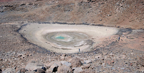
Lake Waiau. The dark rocks surrounding the pale area mark the usual edge of the lake. There are people at the bottom and right side of the lake for scale. (Photo from USGS).

Lake Waiau’s dramatic shrinking has been going on for at least a year. The reasons are not well understood, but are most likely linked to an ongoing drought in Hawaii, combined with rising temperatures. The lake is perched on what is normally really permeable volcanic cinders (think pumice stone). A layer of clay, permafrost, or some combination of the two (scientists aren’t sure which) rests under the lake bed, normally making the cinders stick together and holding the water in place.

In case you’re wondering, yes- permafrost. During the last Ice Age, there were glaciers on Mauna Loa and Mauna Kea, and there may still be frozen ground a bit under the surface of the top of Mauna Kea (Mauna Loa is too volcanically active).  But if the lake is resting on permafrost, its days are numbered. High-altitude temperatures are increasing three times higher on Mauna Kea than the global average. Even if there’s not a melting layer of permafrost underneath, rising temperatures mean more evaporation, and when combined with little winter snowfall, clearly the lake is already in trouble.
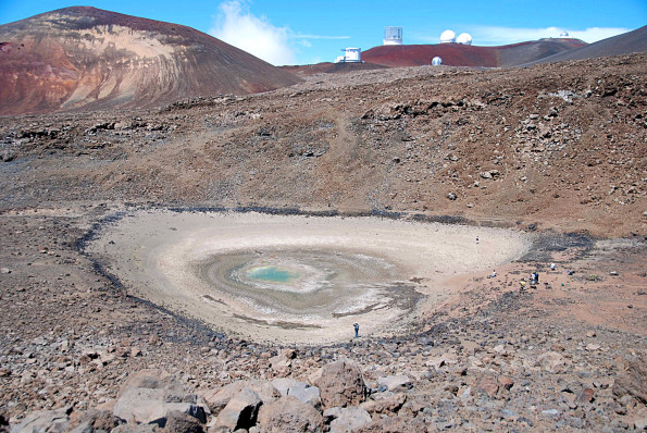
A wider-angle view of Lake Waiau. You can see the cinder cones that make up the top of Mauna Kea, as well as several of the astronomical observatories nearby. (Photo from USGS)

As the only alpine lake in Hawaii, Lake Waiau was and is sacred to Native Hawaiians. From a scientific standpoint, its geology and ecology are unique. While its current problems likely stem from drought, its future is tied to our warming climate. Like many other unique and culturally significant locations worldwide, Lake Waiau’s fate seems to be one of drastic change.
Categories
geekery Hawaii Japan travel

Are paniolo really part of the “American lifestyle”?

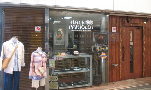
Seen in Nara:

“Hale Paniolo: American Life Style Shop.” (Photo: Y. Fernandez)

I wouldn’t really consider a specifically Hawaiian community of cowboys to be representative of “American lifestyle.” But maybe that’s just me 🙂

Categories
Florida Hawaii outdoors

Honolulu Park in Florida?

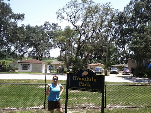
After a recent bike ride on the West Orange Trail, we took a little detour to Ocoee, FL. There’s a small subdivision here with Hawaiian street names, so we thought we’d check it out.

It wasn’t terribly exciting. Indeed, some of the streets on our map had been blocked off by a new faux-Italian subdivision that was going up next door. But we did stop to take a photo at Honolulu Park.

It was hard to see why it had the name. (Photo: Y. Fernandez)

The other interesting thing we saw that day at the Oakland Farmer’s Market was a food truck selling Hawaiian plate lunch! We’ll have to plan a bike ride to try it some time…

Categories
environment Hawaii public participation in science

Crowdsourcing project: Hawaiian Monk Seals

Want to help fund some cool research in an interesting species? Here’s your chance.

Hawaiian Monk Seals, or `Īlioholoikauaua (translated as “dogs that play in the waves”), are a critically endangered and declining species that used to live throughout the Hawaiian archipelago. Today, though, they’re mainly found on the mostly uninhabited Northwest Hawaiian Islands. A relatively small number of seals are also returning to the main Hawaiian Islands, as well, but human encroachment, coastline development, and entanglement with fishing lines make their presence in populated areas more difficult.

Monachus schauinslandi (Hawaiian Monk Seal) underwater at Five Fathom Pinnacle, Hawaii. (Image: Kent Backman, CC-BY-SA-3.0)

While many members of the local community support the conservation of this native species- one of only two native Hawaiian mammals- some fishermen view the seals as competitors for fish. In the last few months, there have been several shootings and clubbings of monk seals who were resting on shore or preparing to give birth. The suspicion is that a very few subsistence fishermen, whose livelihoods are already threatened by coastal development, pollution, and existing overfishing, have been targeting the seals out of frustration. Because seals have only been returning to the main Hawaiian Islands for the last few decades, some fishermen view them as a new competitor, rather than an intrinsic part of the ecosystem that is only now recovering from near-extinction a hundred years ago.

But are the monk seals actually competitors for fish? Previous research on monk seals, using “crittercams” that are attached to the seals’ backs, shows that they actually feed much farther out to sea and deeper than the struggling fishermen. In an effort to understand more about how monk seals behave, the Monk Seal Foundation israising founds for the Hōʻike ā Maka Project:

This is the goal of the Hōʻike ā Maka Project: to understand and share images of the feeding and underwater behavior of Hawaiian monk seals, and lay to rest many of the myths and misconceptions regarding monk seals and their impact on the local marine environment and its resources.  By working with local researchers, ocean users (fishers, divers, surfers and others), students, and NGO’s, NOAA and it’s partners plan to deploy seal-borne video cameras to study how monk seals feed and use their marine habitat in the main Hawaiian Islands.  The discoveries will be critical to understanding the seals’ ecology, ensuring their continued existence, and building a culture of coexistence between man and seal.  Please be a part of this historic partnership and vital work.

National Geographic has donated several crittercams for this project, whose second (and probably more important goal) is to get the local community involved in this research. Both fishermen and local students will be involved in the project. This project could be a great way to help the community- and science- understand the monk seal, and avoid future misguided monk seal killings as the seals are seen more often on the main Hawaiian Islands.

So here’s where the crowdsourcing comes in. While the cameras have been donated, funds are still needed to conduct the research. The organization is trying to raise $25,000 for this project, of which $1,525 has been pledged as of today. To donate, visit the Hōʻike ā Maka Project’s site.

This is an interesting project, and could be a great way to help conserve the monk seal while helping the community be proud of its natural resources.

Categories
Hawaii outdoors travel

More on hiking to Ka’ena Point

It’s always best to hike out to Ka’ena Point either early or late in the day. Even when it’s a bit overcast, the sun can be brutal, and there’s nearly no shade. On this trip, we didn’t make it out there until about 10:30 am, which meant that we were really hiking at the worst time of the day. While it actually wasn’t that hot, it was pretty sunny. The prevailing winds did keep the vog away from us, though.

Vog creeping up in the distance (Photo: Y. Fernandez)

Yan and I lured Dad out on the hike with a promise of cool scenery to sketch and a pretty easy hike. Which it was (on both counts), but it was also pretty hot for a retired Minnesotan hauling art supplies.

I kind of like this photo of Dad & myself, with the Waianaes in the background. (Photo: Y. Fernandez)

I think some of the scenery impressed Dad more than other things. For example, the big sea arch and the blowhole seemed to hold his attention…

One of the sea arches on the way to the point- I counted about three on this trip. (Photo: Y. Fernandez)

…While the abandoned car did not. To be fair, it looked much more like a car last year.

Will there be anything left next time we hike out there? (Photo: Y. Fernandez)
Categories
birds Hawaii outdoors travel

Ka’ena Point

On our winter trip to Hawaii, we took a hike out to Ka’ena Point, the northwestern tip of Oahu. In contrast to last year, it was quite dry out there.

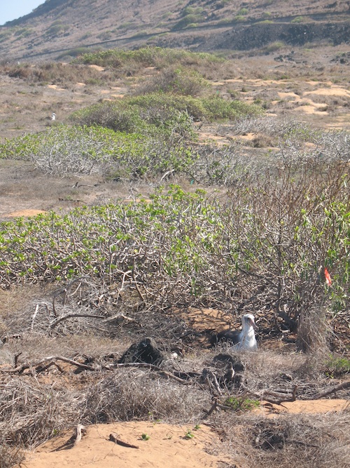
Nesting Laysan Albatross, Ka'ena Point
Nesting Laysan Albatrosses, Ka'ena Point

We saw quite a few Laysan Albatrosses here, nesting. No Wedge-tailed Shearwaters, though.

Another view of the albatross.

Other notable bird sightings were a White-tailed Tropicbird, and a very tired looking Cattle Egret winging in to land from apparently way out to sea. They’re not seabirds, though they do apparently fly along the coast from roosting sites to feeding areas. I have no idea where this one had been- it appeared to be heading straight from Kauai, which is probably not realistic- the Ka’ie’ie Waho Channel is 72 miles wide!

We also saw two Monk Seals lounging on the rocks, as well as some Humpback Whales out to sea. There were also some neat critters (and algae) in the tidepools. So not a spectacular day for wildlife, but we saw some cool stuff.

Endangered Hawaiian Monk Seal (the lazy grey blob in the center of the frame)
Categories
Hawaii outdoors science news

Time-lapse Hawaii lava lake video

This cool new infrared video shows the draining and refilling of the lava lake in Pu`u `Ō`ō. Pu`u `Ō`ō is one of the craters on Kīlauea Volcano, and it’s been active for over two decades.Here’s what the crater looks like in daylight:

Image by USGS.

This time-lapse video shows the activity in the lava lake over the past two months.

For more info on Pu`u `Ō`ō, go to the HVO website. The USGS has quite a few photos and videos here.

Categories
Hawaii outdoors science news

Science that saves lives: the Hawaiian Volcano Observatory

There’s an interesting article in the most recent edition of Physics Today about the founding of the Hawaiian Volcano Observatory and Thomas Jaggar, its first geologist.

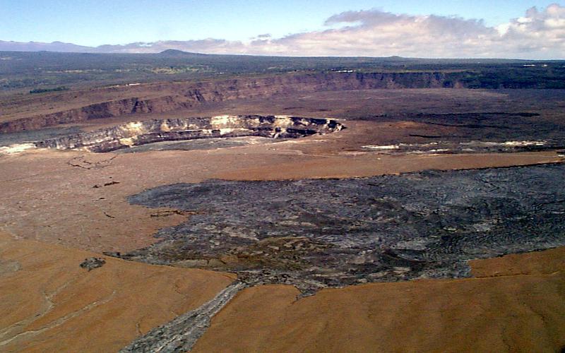
Wiew across Kilauea Caldera, 1997. Halema'uma'u is the crater on the left. HVO is probably the tiny white specks on the crater rim at the upper center of the photo.(J. Kauahikaua/USGS)

The Hawaiian Volcano Observatory (HVO) was founded in 1912 for the purpose of studying Hawaii’s active volcanoes. Located right on the edge of Kīlauea Caldera, HVO has contributed a huge amount to our understanding of volcanoes- both how they function and how to predict their activity. The science of vulcanology has saved hundreds of thousands or even millions of lives worldwide in the last century, and many research techniques have been tested and refined at HVO.

Lava fountain from Kamoamoa eruption, Kilauea: 8 March, 2011 (USGS)

According to the Physics Today article, by John Dvorak, Jaggar was largely inspired to study volcanoes after the 1902 volcanic explosion on the Caribbean island of Martinique, which killed tens of thousands of people in minutes. After working in Italy and Alaska, Jaggar was eventually lured as a tourist to the then-Territory of Hawaii to see the relatively non-explosive Kīlauea Volcano.

At that time, Halemaʻumaʻu crater was much more active than it is today, its bottom covered by a massive lava lake:

The crater was a quarter mile in diameter, with steep inner walls that made descent impossible. At the bottom of the crater, 200 feet below the rim, was a gray metal-like surface made up of large, irregular slabs of solidified lava. The slabs, separated by lightning-like cherry-red lines of molten rock, were in constant motion. Occasionally two slabs would collide, one plunging beneath the other, and send a jet of molten material into the air. The disturbance would send waves of orange-red molten material rolling across the entire surface of the lake. After a few minutes, the lake would calm, the surface would cool, and the slabs would reform. It was a stupendous sight that visitors would eagerly describe to friends and family when they returned home. Jaggar’s description, however, was more poignant than most—for him it was “as if everything within me converged.”

See here for a video of the much smaller currently active vent in Halemaʻumaʻu. Then imagine that view, only about 25 times larger, for a sense of what it looked like at the time…

Lava lake at Kilauea Iki in 1954: about 1/4 the size of the historical Halema'uma'u lava lake. (USGS)

While the article suggests that the experience of Halemaʻumaʻu was a life-changing epiphany for Jaggar, his road to founding HVO was certainly not smooth (euphemistic “domestic infelicities,” anyone?) But Jaggar did persevere, and became the first director of HVO.

Halema'uma'u at night, January 2009 (Mila Zinkova).

Today, HVO has quite an active online presence. General information about the volcanoes it monitors is here.  There are several Kīlauea webcams here of active eruption sites- daytime offers the best views, but the glow from lava is often visible at night. And there are archived photos and videos here. It’s an interesting site to check out, and provides an invaluable service to the public.

Categories
environment Hawaii outdoors travel

Hiking Ahihi-Kinau Natural Area Reserve

The last spot we visited on Maui was the ʻĀhihi-Kīnaʻu Natural Area Reserve. This protected area is located pretty close to the extreme southern point of Haleakalā. It encompasses a slice of land from the uplands down to the coast, and then into shoreline waters. This combination of land and water makes it unique among protected areas in Hawai’i.

ʻĀhihi-Kīnaʻu NAR is located on the southwest rift zone of Haleakalā, which is still an active (though dormant) volcano. In fact, the most recent eruption of Haleakalā flowed through this area, a few hundred years ago (radiocarbon dating suggests this flow is probably older than a traditionally-thought 1790 date). A very young vent, Kalua o Lapa, is a prominent feature upslope from the shoreline, where the hiking trail is located.

Youngest lava flow on Maui.

While ʻĀhihi-Kīnaʻu NAR is largely covered by young lava, there are numerous cultural sites, including, walls, temples, and former garden plots; also, threatened and endangered native dryland plants. This dry and rugged land was inhabited- people once fished and farmed in this area. It’s strikingly similar to the west coast of Hawai’i Island in topography, geology, and general setting.

There is a small blowhole at the edge of this bay- we didn't get a good photo of it, though.

It’s the aquatic resources of ʻĀhihi-Kīnaʻu NAR that are most known- coral reefs, surf spots, and anchialine ponds. Sea turtles, dolphins, and monk seals frequent the area, and the offshore waters are part of the Humpback Whale Reserve. However, these coastal sites are so well known that they’re currently closed to visitors. If there are any natural areas that are being “loved to death,” ʻĀhihi-Kīnaʻu’s reefs and pools are definitely among them. Currently, you can visit two areas of the reserve: a swimming/surfing area at the entrance to the reserve, and a short trail that goes past a number of cultural sites to La Perouse bay. This is the trail that we took.

Map from HI DLNR.

The trail hugs the coast, crossing both rugged ‘a’a and smooth pahoehoe lava flows. As you walk along the coast, there are a few tiny pockets of tan coral sand- the rest of the shoreline area is rocky cliffs, boulder-strewn beaches, and one larger sandy beach with a mix of black and tan sand. While we were there, clouds were rolling in, part of the rain system that had been raking the islands all weekend. We walked past several crumbling rock walls and other structures (evidence of the need to better protect the historical sites of the area).

Kaho'olawe, with clouds rolling in.

We went on the trail as far as a cobble-covered beach, passing through a kiawe forest full of noisy Gray Francolins and sharp-horned feral goats (the latter a bane of existence for the remaining native vegetation). A tour group on horseback passed us, coming back; they were turned back by a huge fallen tree in the road that we had to scramble under.

Fresh black basalt cobbles predominated at the beach, but there were also large chunks of wave-rounded coral, hinting at the productive reef that lay just out of sight. Upslope, we saw Haleakalā disappearing into the encircling clouds; out towards the sea, waves crashed onto shore.

I’d love to come back here some day and spend more time in the area. It reminded me strongly of the Kona Coast. While access to the most critical natural resources is limited, there are still other hiking trails that appear to be open, which we didn’t have time to explore. Definitely a place to come back to, at some point.

Categories
birds Hawaii outdoors

Lowland birding on Maui

I’m not sure if I’ve mentioned this before, but the West Maui mountains creep me out. They’re intermediate in erosion between the massive-yet-pimpled with cinder cones peaks (Mauna Kea, Hualalai, and Haleakalā) and the deeply eroded ranges found on O’ahu and Kaua’i. I just find West Maui too pointy- like it’s obviously just beginning to be dissected into sharp edges, but before it’s been softened into fluted valleys and gentle hills.

Pointy peaks of West Maui-the biggest valley is Iao Valley.

…but I digress. I intended in this post to talk about a few birding sites on Maui that are easily accessible, in lowland areas. We visited both of these locations in December 2010.

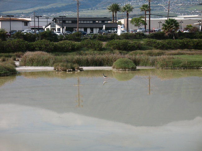
The above photo is from one of those sites, a wildlife sanctuary called Kanahā Pond. This sight is literally just down the street from the Wailuku Kahului airport, so it was our first stop when we got in to Maui. While it backs onto a business/industrial area, it’s one of the largest (and few remaining) wetland sites on Maui. It harbors a large number of migratory species, as well as four of the ‘big five’ breeding waterfowl: the endemic Hawaiian Coot (endangered species), endemic Hawaiian Moorhen (endangered subspecies of the Common Moorhen), endemic Hawaiian Stilt (endangered subspecies of the Black-Necked Stilt), and the native Black-crowned Night-Heron. The endangered Hawaiian Duck is not found here, though some of the Mallards seen here might be hybrids with this species.

Hawaiian stilt in Kanaha pond.

If you’re into birding, this is definitely a good location to check out- if you’re not a birder, why not park it here for a while with a snack or beverage from a nearby shop and check out the action? Species we saw: Laughing Gull, Stilt, Cattle Egret, Myna, Night-Heron, Spotted Dove, House Sparrow, Pacific Golden-Plover, Coot, and Red-Crested Cardinal.

Black-crowned night heron, or auku'u.

The other wetland site that’s easily accessible on Maui is Kealia Pond, a National Wildlife refuge on the south shore of the isthmus. You can do more walking around here. There are two entrances to this site. One parking area, along the shoreline off of Kihei Rd/Hwy 310, gives access to the beach and a boardwalk with interpretive signage. This is the nicer location. The other access point, off of Hwy 311/Mokulele Rd, is less aesthetically pleasing (i.e., muddy and full of midges), but much better for birding.

You can access the pond itself via a series of berms that you can walk along. When we were there, it was quite muddy. The midges don’t bite, but they will swarm all over you- this was distracting and oogy for us, and would probably be really creepy if you have a problem with insects.

Kealia pond- idyllic except for the massive clouds of midges.

You can see a much larger part of the pond here than at Kanahā Pond, but that also means the birds can see you and be startled. We saw quite a few more species here: American Wigeon, Zebra Dove, Stilt, Cattle Egret, Chestnut Munia, Myna,  Coot, Least Sandpiper, Mallard, Northern Cardinal, Northern Pintail, Northern Shoveler, Orange-cheeked Waxbill, Pacific Golden-Plover, Ring-billed Gull, Sanderling, White-faced Ibis, and Night-Heron. I also saw a goose, which flew away before I could make a positive i.d.- possibly a White-fronted goose. I’d definitely recommend this site for those interested in birds.

So, two good lowland wetland birding sites on Maui. I have one more Maui post planned, then I’ll be moving on to other topics.