Categories
birds environment Hawaii outdoors

Hiking Waikamoi Preserve

'Alauahio (image from Maui Forest Bird Recovery Project)

One of the reasons we went to Maui on our recent trip back to Hawai’i was to look for endemic birds. There are three species in particular on Haleakalā that I really wanted to see, and hadn’t seen before: the Maui ‘Alauahio (or Maui Creeper), ‘Akohekohe (or Crested Honeycreeper), and Maui Parrotbill (recently given the Hawaiian name of Kiwikiu). All three species are endangered, the latter two critically (there are perhaps 3,800 ‘Akohekohe and 500 Parrotbills remaining). The Maui Forest Bird Recovery Project has a lot of info on these birds and their conservation.

'Akohekohe (image from USGS/Wikipedia)

While the ‘Alauhio is fairly easy to see within Haleakalā National Park (at the Hosmer Grove campground), the other two species have a more restricted range. The best way to see these birds is to go on a hike into the Nature Conservancy’s Waikamoi Preserve, which is located just downslope of the north side of the park. Three of us went on this hike: myself, my husband Yan, and my cousin David. Surprisingly, no one else had signed up for the hike- this one is only offered once a month.

Maui Parrotbill (image from Maui Forest Bird Recovery Project)

TNC offers guided hikes into the preserve in two locations: we opted to go on the Boardwalk hike, as we’d heard there was more of a chance of seeing ‘Akohekohe on this route (Parrotbills are much harder to find). The hike starts at about 6,800 ft, and descends about 1,000 feet. We’d been warned about cold and rain (it does descend into cloud forest), but the weather was pretty great. Given that the day after our hike a big storm system swept through and it poured all day in this area, we were pretty lucky.

After scrubbing our boots to remove any alien plant seeds, we climbed through the gate to the Preserve. While the forest is managed to keep feral goats and pigs out, we thought this warning sign at the entrance might be overstating the hunting frequency by a wee bit:

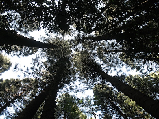
At upper elevations, the forest is a mix of alien species introduced to combat erosion caused by feral goats and cattle. These included various pines and redwood trees, which you can see in the background of this photo- what you see in the foreground are ‘Ohi’a lehua trees, one of the dominant native species in Hawaiian forests.:

Upper Waikamoi Preserve.

Throughout this area, you can hear the calls and whirring wings of the native honeycreepers: mainly ‘I’iwi, ‘Apapane, ‘Amakihi and ‘Alauahio at this elevation. It was definitely very cool! These birds are mostly restricted to high-elevation forest without mosquitoes, which carry avian malaria- a big reason they’re threatened. Some are nectar-feeders (the big poofy flowers of the ‘Ohi’a are a favorite) while others eat insects or seeds. It was interesting to see that they were able to use the alien parts of the forest for shelter, if not for food- I wasn’t expecting that.

Ohia lehua blossoms (image by P. Fukunaga, USGS)

Once we got into the relatively pristine cloud forest, we saw a huge diversity of native plants- sadly, my native plant ID skills have eroded and I couldn’t identify many of them. The trail here goes on a boardwalk path that’s effectively a very long set of stairs. The ground here was covered with moss and ferns- an indication of the high level of rainfall. The boardwalk keeps damage to the forest floor at a minimum and provides solid footing. It was pretty damp.

And, right as we got to the cloud forest, we saw four ‘Akohekohe! It was pretty cool- our guide, Michelle, was talking about the birds and the forest, and discussing how rare they were and how uncommon it was to see them. And then one-two-three-four: they landed on a tree behind her. Excellent timing.

At the bottom of the boardwalk, there’s a platform and a seating area. On the rare non-cloudy days, there’s probably a great view from here to the ocean. We hung out here for maybe an hour, looking for birds and just listening to the total absence of human noise. Birds, insects, the wind in the trees: that is all you hear in this spot.

David, going back up the stairs.

Then it came time to go back up the trail. We knew that the rain front was rolling in- it was getting mistier and rain was starting to fall. It didn’t get completely foggy until we got back up to the top, though. The weather was excellent, overall. We never did see any Parrotbills, but that was a very slim chance anyway. I think the ‘Akohekohe is probably the most endangered bird species I’ve seen. And we saw several of them, with their cute little feathery crests.

I’d been a bit worried about hiking at this elevation, after living at sea level for so long, but it wasn’t a problem. It probably helped that we’d been at the summit for a few hours beforehand, so the 5,000-ft drop to the trailhead made us breathe much easier.

Overall, we got to spend several hours immersed in the sights, sounds, and scents of one of the most unique forests on the planet. This was truly a wonderful experience, and definitely made the trip to Maui worth it all by itself.

Categories
birds environment science communication

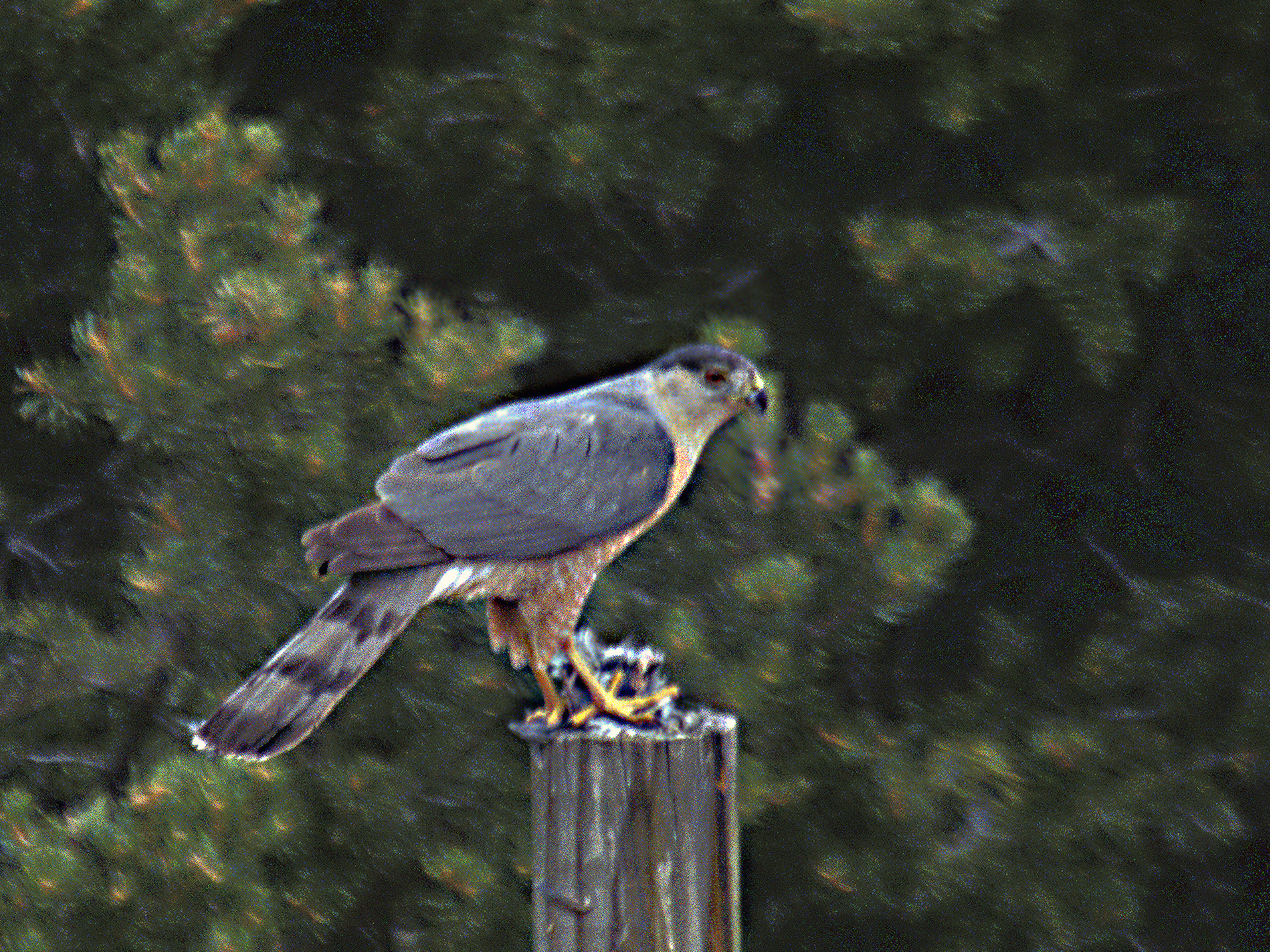
Cooper’s hawk in library captured

The Cooper’s Hawk that’s been trapped inside the US Library of Congress reading room for the past week has been captured. She’s underweight, and will have to be rehabilitated before she’s released (presumably away from downtown Washington, DC).

The hawk strikes a dramatic pose (Library of Congress blog).

I find this account of the capture interesting. You can generally tell the sex of raptors apart, because of size (females are larger than males) and sometimes markings. You can also tell she’s a juvenile- adults have different markings:

Adult Cooper's Hawk (Peter Wallack, Wikipedia).

However, even though this hawk’s gender was known, reporters are having a really hard time referring to her as ‘her’- they seem to bounce between referring to her with female pronouns and gender-neutral pronouns.

I wonder what prompts this sort of confusion, in a case where the sex of a specific animal is definitely known. I know English a rare European language in which species aren’t ‘assigned’ a gender automatically (my German-speaking grandmother constantly refers to Noe as ‘he’ even though she knows she’s female!) I know the convention is to refer to animals as ‘it’- at least wild animals, that is. Maybe the author of this piece just can’t get past that convention? Then, of course, there are all the commentators that call the bird ‘he’- maybe because she’s a powerful bird of prey and therefore must be male?

This gets at one annoying issue in our cultural depictions of animals in popular media- for example, in movies like “A Bug’s Life” and “Barnyard“. Especially in animated films, the social behaviors in different species are rarely depicted correctly. This ranges from depicting animals as the normative nuclear family (e.g., “Aristocats“), to turning female animals male (as in “A Bug’s Life” and “Barnyard”). The case of “Barnyard” is particularly egregious- in that movie, the protagonist is a cow (complete with udders), but is voiced by a male actor.

Notice the offending organ is covered up in this DVD cover (Wikipedia).

Unless there is something seriously wrong with that poor bull’s genitalia, this is a really unfortunate mistake. How can you design a character whose salient bits are a hanging out for all to see, and then assign the wrong gender to it? (Okay, in this case udders are not genitalia, but you get my point.)

…Though I suppose I should give the hawk commenters the benefit of the doubt and concede that, indeed, birds do not have dangling penii to make immediate identification obvious.

Categories
birds environment Hawaii outdoors

Hiking to Kaena Point

The north-west tip of O’ahu is Ka’ena Point. This, the tip of the Wai’anae Mountains, is the one part of the island that’s not reachable by (paved) roads. There used to be both a dirt road and a railroad out here (the railroad for sugarcane transport). Now, the railroad has been removed and the road is extremely non-maintained.

You can actually drive along the non-maintained part of the road for a ways, from either side- fishermen do it. But with a rental car, you probably don’t want to risk it. This car, which apparently broke down at some point, has been out near the end of the road for a few years- every time we go back it’s just a bit more degraded. Last year, for example, the seats were still in decent shape.

Guess someone stripped it, then abandoned it...

A few miles toward the point from either side, the remaining road is fenced off. The reason is that this is one of the last non-developed coastal sites on O’ahu, because of its remoteness. It’s home to several species of threatened plant, and also serves as nesting ground for native seabirds: Laysan albatrosses and Wedge-tailed shearwaters, as well as a pupping spot for endangered Hawaiian Monk seals. The fence is intended to keep predators from slaughtering these ground-nesting birds.

A few dozen nest here each winter.

I think Laysan albatrosses are one of the more sophisticated-looking birds: isn’t that contrast between white head, slaty body, and subtly shaded eye mask cool?

Photo: Jlfutari at wikipedia.com

Back in the day, I did an internship with the Fish & Wildlife Service on Kaua’i. One of the things I got to do was help band Laysan albatrosses. These are the smallest albatross species, but still have a wingspan that’s up to two meters in length. More importantly for banding, those beaks are razor-sharp; we learned how to get around them pretty quickly! Despite their size, they don’t weigh much, and I strongly remember thinking that they smelled like feather pillows (unlike the Red-footed boobies, who would regurgitate half-digested fish onto you when approached- gross).

At any rate, Ka’ena Point is one of the last places on the main Hawaiian Islands where these beauties nest, at the end of the Wai’anaes.

Albatrosses nest on the ground; shearwaters dig burrows.

The day we went out, it was both hot (“Ka’ena” means “the hot”) and the surf was up. We didn’t see any Monk seals, but that just meant that we could go cool our heels in the tidepools.

All in all, this is a good hike on a winter day- there’s pretty much no shade, so it’s nice when it’s a bit cloudy. It can also be pretty breezy out at the point. While it’s generally quite dry, we’d just had rain and there were a lot of mud puddles on the road. It was pretty easy to get around them, though. Take water and a snack, and be prepared to just sit at the point for a while and watch the waves and the albatrosses coming in to land.

Categories
birds environment science communication

Flockalypse redux

Today, I’m revisiting my recent blog post on the “Flockalypse” to try to shed some light on what scientists mean when they say that large numbers of birds being killed “happens all the time.” I’ve seen this phrase in the news a lot lately, and I want to point out that it does not mean that scientists think that these types of deaths are “okay.”

Instead of taking “happens all the time” as a dismissal of the importance of mass bird die-offs, let’s look at as recognizing that many, many birds are killed every day from causes that are directly related to human activity. How many? Well, that’s hard to estimate, for a couple of reasons. One big reason is that many of these deaths occur at night, and night-roaming scavengers quickly dispose of the evidence.

Here’s one estimate of numbers. A 2005 paper by Wallace Erickson, Gregory Johnson, and David Young (“A Summary and Comparison of Bird Mortality from Anthropogenic Causes with an Emphasis on Collisions“) estimates that 500 million-1 billion birds are killed each year in the U.S. alone from human-related causes. This includes:

  • Collisions with buildings – 550 million (58.2%)
  • Collisions with power lines – 130 million (13.7%)
  • Cats – 100 million (10.6%)
  • Cars, trucks, etc. – 80 million (8.5%)
  • Pesticides – 67 million (7.1%)
  • Communication towers – 4.5 million (0.5%)
  • Wind turbines – 28.5 thousand (less than 0.01%)
  • Airplanes – 25 thousand (less than 0.01%)
  • Other sources (oil spills, fishing by-catch, etc) – did not estimate

While recent large mortality events have been in the news, the point I want to make is that a constant level of bird deaths occurs constantly due to human-related factors. These are large numbers. One in six bird species worldwide is threatened with extinction, because of the factors listed above plus things like habitat loss, invasive species, and climate change.

The endangered Florida Scrub-Jay (byVvAndromedavV, wikipedia.org)

Looking at this list, you should be able to see a number of ways that we can work to prevent at least some of these deaths. Things like making windows and other structures more visible to birds, keeping cats indoors, and minimizing use of pesticides are all crucial to the survival of many species. (For more info on some of these efforts, see the American Bird Conservancy’s site.)

So, can public attention to the recent dramatic bird deaths be used to spark wider awareness of what we can do to prevent the constant slow preventable deaths of birds? Hopefully, it can- and many science communicators are trying to get the word out. Human population growth and natural resource use, habitat loss and invasive species, along with global climate change, are ever-increasing threats to the survival of many species. We should try to prevent this constant rate of attrition whenever we can.

Categories
environment Hawaii outdoors

Hiking Puu Ohia – Kalawahine Trails

Just mauka (mountainward) of urban Honolulu is a ~19.6 mile system of trails in the Ko`olau Mountains: the Honolulu Mauka Trail System. This system includes the Judd Trail, which I talked about in a previous post. While the Judd Trail is in Nu’uanu Valley, most of this trail system is on the south side of the crest of the Ko’olau range. It’s probably the best-maintained trail system on Oahu, and one of my favorite places to hike.

The map above is centered on the area where the trail system is: the area marked “Honolulu Watershed Forest Reserve” is in the back of Manoa Valley (there are trails all along the ridge lines on all three sides), the central area marked “Makiki-Lower Punchbowl-Tantalus” contains several trails, and then Nu’uanu Valley (which Hwy 61 runs through) has a few trails on the east side. Downtown Honolulu is in the lower left, and Waikiki is just off the map to the lower right.

One of the hikes I’ve done a few times is the Pu’u ‘Ohi’a Trail, which goes to the top of one of the high points in this part of the range, called Pu’u ‘Ohi’a (‘Ohi’a Tree Hill), or more popularly, Tantalus. The summit is about 2,000 feet; the trailhead starts at about 1400 (?) feet. It’s a bit of a climb. Part of the trail goes through bamboo forest, which is a bit eerie- the bamboo (which is invasive) blocks out a lot of light.

Escaped cockatoos live in upper Manoa Valley.

We actually went a bit onto the Manoa Cliffs Trail, which as you might guess from the name, goes along the cliffside above Manoa Valley. I have to say that Manoa is the prettiest valley on Oahu. Others may disagree, of course 🙂

After our quick view of Manoa Valley, we took the Kalawahine Trail, which hugs the western side of Pu’u ‘Ohi’a. The narrow valley on this side is Pauoa Valley. From this side, you get a great view of Nu’uanu valley to the north, and can see across the Ko’olau Mountains to Kailua.

Upper Nu'uanu Valley, with Kailua off in the distance.

Further south along the Kalawahine Trail, you get a great view of downtown Honolulu and Pearl Harbor off to the west, along with the Wai’anae Range (which you can’t see in this photo).

Downtown Honolulu.

The Kalawahine Trail is really botanically interesting: there are actually quite a few native species here. Part of the forest here is fenced (to exclude mainly pigs) and is intended to be a native tree snail preserve. Tree snails were very diverse in Hawaii before human settlement; now habitat loss, collecting, and an invasive predatory snail have made most of the species extinct. A few species are hanging on in remote mountain refuges. Native forest birds are often sighted here, but we didn’t see any this time. There are also quite a few native plants, including a stand of hibiscus trees that were blooming.

This is also a great trail to look at ferns: there are quite a few different species here (both native and introduced). This was a fun place to botanize when I was in college.

For scale, this boulder is about a meter in height.

The Honolulu Mauka trail system has some pretty diverse terrain, vegetation, and views. It’s also pretty accessible from either downtown or Waikiki. You can access it either by car (though parking is limited & the area is sometimes prone to break-ins) or by bus. It’s definitely one of the unique things about living in Honolulu…

Categories
birds environment geekery

Four-and-twenty blackbirds

In the news recently has been the discovery of thousands of dead Red-winged blackbirds (with a few other species) in Arkansas and Louisiana.

Red-winged blackbird. Photo by Cephas, wikipedia.org.

Red-winged blackbirds congregate in massive communal roosts during the non-breeding season, in flocks that can number literally up to hundreds of thousands (other species do this too: robins, crows, ravens, vultures…) During the breeding season, the males stake out territories, generally in marshes, and “protect” the nests of a number of females within their territory. Notice I don’t say the females are their “mates”- in fact, what are known as “extra-pair copulations” are common in this species, and neither males nor females are monogamous.

Blackbird flock. Photo by Edibobb, wikipedia.org.

Back to the news- the most likely explanation is that the Arkansas birds died when a sleeping flock was startled by fireworks going off overhead, freaked out, and started flying into one another and other objects at high speed (however, tests are still being done for possible toxins- these birds will eat crops, and occasionally people will put out poison for them). The Louisiana birds apparently collided with power lines.

…Of course, some are into this sort of thing:

epic fail photos - Speculations FAIL

Bird collisions happen all the time– this event is definitely not unique (and, as the linked post points out, this event is tiny on the scale of bird mass deaths from human-influenced causes.)

The title of my post comes from a common English nursery rhyme, “Sing a Song of Sixpence.” I won’t get into the possible underlying meanings of the rhyme, but here it is:

Sing a song of sixpence,
A pocket full of rye.
Four and twenty blackbirds,
Baked in a pie.

When the pie was opened,
The birds began to sing;
Wasn’t that a dainty dish,
To set before the king?

The king was in his counting house,
Counting out his money;
The queen was in the parlour,
Eating bread and honey.

The maid was in the garden,
Hanging out the clothes;
When down came a blackbird
And pecked off her nose.

The blackbirds “baked” into the pie would be Eurasian blackbirds, not Red-winged blackbirds.

Eurasian blackbird. Photo by Snowmanradio, wikipedia.org.

In the 16th Century, it was apparently a big deal to create pies that, when cut open, contained birds that would fly out and away. Hopefully they would then angrily poop on the diners’ heads before flying to freedom, but I sadly can find no evidence for that outcome…

Categories
environment Hawaii outdoors

Walking the Judd Trail

Another trail accessed via the Pali Highway is the Judd Trail, also known as “Jackass Ginger,” for a waterfall along Nuuanu Stream, which you walk along part of the way.

View of Nuuanu Stream

It’s a pretty small waterfall, but a popular swimming spot. I have no idea how it got its name.

There is ginger in the area, though...

The Judd Trail is a loop, which takes you above Nuuanu stream and into the forest. Most of Hawaii’s native forests were effectively eaten to the ground by feral goats and cattle after Western contact, and were replanted with non-native species once people realized that massive erosion problems and reduction of stream flows were a result. The Judd Trail runs through non-native forest, including dramatic plantings of Norfolk Island pines. It’s also named after one of the early foresters in Hawaii, Charles Judd.
pines

I’ve heard descriptions of this trail as running through “Hawaii’s beautiful native forest”- this is ridiculous. I’m pretty sure I didn’t see a single native species along the route- maybe a fern or two.

No native species here...

But it’s a nice, cool trail on a hot day.

Categories
environment Hawaii outdoors travel

Hiking Old Pali Highway

On our recent trip to Hawaii, we got to do a lot of hiking. Nothing too serious, but we did try to do at least short hikes each day. We were fairly successful when it wasn’t raining.

One of our first hikes was on Oahu, on the Old Pali Highway. This route leads along a decommissioned road that run between Honolulu and the Windward side of Oahu.

Google terrain map showing the Pali Hwy. The "gap" in the mountain range is actually a ~1000-foot cliff.

Oahu was formed by two volcanoes, which have now eroded to form the western Wai’anae and eastern Ko’olau mountains. Millions of years ago, about half of the Ko’olau volcano slid off in a massive landslide, creating a 100-mile long debris field under the ocean to the northeast, and leaving a long, tall series of cliffs on the remaining above-water part of the volcano. This cliff (the Pali) limits travel between the coastal Windward side of the island and the plateau between the Wa’anae and Ko’olau ranges.

Steep part of the Pali from the Windward coast (from NOAA).

The Old Pali Highway takes advantage of a slight gap in the range, where there is only about a 1000-foot vertical cliff between the two sides, rather than the ~2400-foot cliff that’s found elsewhere. However, this road was always wet, steep, narrow, and dangerous to travel. It was eventually replaced by the (new) Pali Highway, which is larger and uses two tunnels and a set of ramps to make the current highway less steep. Hikers can take the Old Pali highway from its high point at the Pali Overlook down to where it connects with a state trail to a waterfall.

Stream valley, not visible from road.

When walking on the Old Pali Highway, you can really get a sense for how much more sketchy this connection between the two sides of the island was at the time. Water constantly seeps onto the road from the porous basalt, and ferns and other plants abound. The hike gives you views into some pretty gorgeous valleys that aren’t visible form the new road.

Waterfalls were running because of all the recent rain.

We hiked this as a loop from the top down, then back up. We did go a bit onto the waterfall trail, but it was starting to get dark (and we were hearing wild pigs), so we went back up.

View of Kailua & Olomana (double peak in foreground).

There are some interesting birds on this trail, but not much that’s native: it lies within the range of avian malaria-carrying mosquitoes that have decimated most native forest bird species in Hawaii. Within the mosquito zone, there are pretty much no more native forest birds. Scientists are quite concerned about the effect of global warming on Hawaiian forest birds: mosquitoes are limited to lower elevations because of cold mountain air. As the climate warms, their zone of infiltration expands up into the former mountain refuges of the birds, who have no immunity to avian malaria.

Feral chickens, descended from Polynesian Jungle fowl, at the Pali Overlook.

This is an easy-to-get-to hike that’s not too strenuous, very scenic, and has some history. The footing is mostly good (though slippery in spots), and parts of it are a bit steep. Nuuanu Valley, which the Pali Highway runs through from Honolulu, has some pretty significant historic sites, and the Pali Overlook itself was the site of a dramatic and bloody battle when Kamehameha was trying to conquer Oahu- Oahuans’ first encounter with cannon, people being pushed to their deaths over the cliff with spears, and other details. It’s interesting (though disturbing) to contemplate that event here.

Categories
environment meetings

Not quite buried…

Back from the Humanities & Sustainability conference, and embroiled in getting ready for my first candidacy exam this week… My talk went well, and contributed some ideas to the end of session discussion, so that rates a smiley face 🙂 One of the themes of several talks was the importance of metaphor for communicating science and sustainability issues, which is an interest of mine.

Here’s an interesting (unrelated) link, about social networking and social activism: can one help coordinate the other? It’s a good contrast to a few of the texts on my third reading list, which I’ll be starting in on shortly…

Categories
environment exam readings rhetoric science communication

Exam readings: Rhetoric and conservation management

Two papers today, involving rhetoric and environmental technical communication. I’m getting down to the end of my public understanding of science reading list, but also getting close to exam #1. So I’ll just have to concentrate on getting ready for that for the next week and a half…

First: Margaret B. Graham and Neil Lindeman. “The Rhetoric and Politics of Science in the Case of the Missouri River System.” Journal of Business and Technical Communication 19.4 (2005): 422-448.

Summary: The authors analyze rhetorical differences in two science reports by the US Fish & Wildlife Svc. in 2000 and 2003; the 03 report was created by a different writing team after changes in the political administration. While the major difference between the reports is different flow recommendations, there were significant differences in narrative structure and omission/inclusion of facts that create very different rhetorical spaces. One example is use of narrative: the 00 report begins with a historical narrative that describes the river as a dynamic system later harmed by humans (incidentally creating a romantic space that leaves little room for people in a restored river); the 03 report replaces this narrative with statistics and doesn’t evoke the river as an ecosystem (making it easier to justify human alterations.) In another example, the 00 report downplays scientific uncertainty (justifying the recommendation of large remedial changes for restoration) while the 03 report emphasizes it (setting up the recommendation for minimal remedial changes.) Rhetorically, control of information presented shapes the response of readers. Graham & Lindeman attribute these differences in the reports to the composition of the (anonymous) writing teams, motivated by their political and social interests. For them, the keys in understanding science communication are: knowledge of the context of the scientific argument(s) presented, understanding the structure and informational content of documents produced, and consideration of the audiences for whom communications are intended (both apparent (e.g., public) and hidden (e.g., supervisors).)

Comments: While this type of analysis is particularly applicable to government/institutional science communication, there are some broader issues as well. The increased public involvement in river decisions recommended in the 03 report is something many scholars have called for, but the authors point out that this sort of involvement often gives bad environmental results. Expertise in a scientific issue can counter manipulative interests in such participatory settings (rather than just being used to maintain a status quo.) There are also ethical concerns raised in this paper that would be applicable to communication research (e.g., framing.)

Links to: Groffman et al. (environmental communication); Yearley (scientific uncertainty often makes sci. a bad ally to environmentalism, public participation in decision-making for environmental issues can lead to bad results)

Second: Marie Paretti. “Managing Nature/Empowering Decision-Makers: A Case Study of Forest Management Plans.” Technical Communication Quarterly 12.4 (2003): 439-459.

Summary: Paretti analyzes forest management plans (FMPs), whose function is to inform landowners and provide practical knowledge (unlike general environmental communication, these plans give advice to active resource managers.) Most research in science communication to landowners has been in how to reach them and how to communicate controversies, not how to communicate technical information effectively. Paretti outlines four models of communication: technocratic (no interchange), Jeffersonian (experts give advice to public), Interactive Jeffersonian (experts give technical advice, public gives values), and Social Constructionist (information and values go both ways). The IJ model describes current practice; Paretti advocates the SC model. FMPs begin by the landowner stating their goals, then the expert provides a detailed description of natural resources and recommendations for achieving goals. The rhetoric of FMPs maintains the landowner-expert divide and leaves owner a novice on own land in some ways: language style is technical, recommendations are framed as directives, and the decision process is not articulated. Paretti suggests changing the consultation process: start by listing resources, then consult together on goals, then have expert give recommendations (while making specific suggestions, using different language, IDing places where local knowledge would be useful).

Comments: Paretti advocates a collaborative, discussion-based consultation process that values non-technical knowledge and emphasizes how the decision-making process works so that the landowner can be educated about it. These recommendations follow a similar pattern to other authors calling for more public participation in socio-technological issues; in this case, the landowners presumable have some local knowledge of their land, so would have something to bring to the table themselves.

Links to: Graham & Lindeman (participatory process not always best for envt.)